File:Sudan political map 2000.jpg
From FollowTheScore
No higher resolution available.
Sudan_political_map_2000.jpg (487 × 599 pixels, file size: 342 KB, MIME type: image/jpeg)
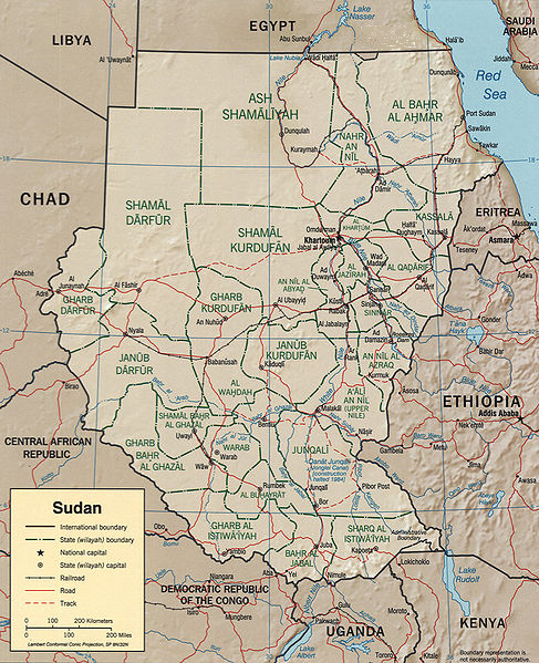
CIA map of Sudan from 2000
http://hdl.loc.gov/loc.gmd/g8310.ct001564

|
This map is available from the United States Library of Congress's Geography & Map Division
under the digital ID g8310.ct001564. This tag does not indicate the copyright status of the attached work. A normal copyright tag is still required. See Commons:Licensing.
|
| This image is a work of a Central Intelligence Agency employee, taken or made as part of that person's official duties. As a Work of the United States Government, this image or media is in the public domain in the United States.
|

|
File history
Click on a date/time to view the file as it appeared at that time.
| Date/Time | Thumbnail | Dimensions | User | Comment | |
|---|---|---|---|---|---|
| current | 12:04, 2 February 2017 | | 487 × 599 (342 KB) | عادل | borders correction |
File usage
The following page links to this file: